Memphis Riverfront Placemaking
 A million years and a month ago I went to the Friends for Our Riverfront sponsored, Project for Public Spaces led placemaking session for the Memphis riverfront. 135 citizens attended, according to the Commercial Appeal. Members of the FfoR (of course), Memphis Heritage, University of Memphis Department of City Planning, Memphis and Shelby County Office of Planning and Development, and the Riverfront Development Corporation (including its Executive Director, Benny Lendermon -- which is great) and bloggerdom attended, among others.
It began with a short introduction to placemaking by PPS' leader Fred Kent and examples of good and bad examples of waterfront places around the world. We then broke up into groups to wander the riverfront between Adams and Beale, the Mississippi and Court Square, and play the placemaking game.
 Every participant had the same questions to answer, which included a multiple choice questionnaire about the place (e.g., "rate the place's accessibility", 1 to 5), plus more general questions, like "List short-term changes that could be made to the space to make it more attractive", "Ask users of the space for their reaction to the space." (these are from memory so I've probably gotten them wrong, but not, I think, that wrong.)
 My group's destination/space was the parking garage next to Confederate Park. Despite all their other acrimony, the RDC and the Friends for Our Riverfront agree that this parking garage should be demolished. It's what to do with the space after demolition that's the major issue.
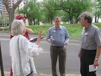
My group only had me and two other people in it. One was the group leader, Jack Tucker, architect and one of the pioneers since the 1970s of the downtown renaissance. The other group member was Tandy Gilliland, the founding president of the Chickasaw Bluffs Conservancy, the group responsible for giving Memphis the Bluff Walk.

(There are 2 successes from the annals of Memphis activism that blow my mind: the citizens who fought and defeated the proposal to put Interstate 40 through Overton Park, and the citizens who fought the City, powerful developers and powerful property owners and won the right to build the public amenity known as the Bluff Walk. In both cases I wonder, "how the hell did they do that?!")
Much of the time allotted for the placemaking game, I spent placetalking with Mr. Tucker and Mrs. Gilliland (or snapping pictures of surgeons dressed as giant green parasitic insects) instead.
But I did manage to snap this picture, at the foot of the Bluff on Adams.
 Across Riverside is the Visitor Center and the harbor but there is no light or crosswalk and a cyclone fence to block you if you could cross. To get from Adams to the Visitor Center, you have to walk down to Jefferson, cross Riverside, then walk to the Visitor Center, which is actually aligned with Adams.
Someone coming from one of the Convention Center hotels would have to take this circuitous route; worse, a traveler who has stopped at the Visitors Center and might like to try out Mud Island has to make the same serpentine route in reverse to get to the Mud Island bridge and monorail. Here's a video to help confuse you.
Here's one unlucky family experiencing the painfully out-of-the-way walk.

It was pretty obvious how bad this particular problem was and the people who can fix it the fastest, the RDC, were there to walk and witness the problem.
When we returned from the placemaking game, we assembled the many ideas and each group presented theirs. The Friends for our Riverfront and PPS will be creating a report based on the ideas.
Hopefully the report will make clear next steps.

Labels: placemaking, riverfront


